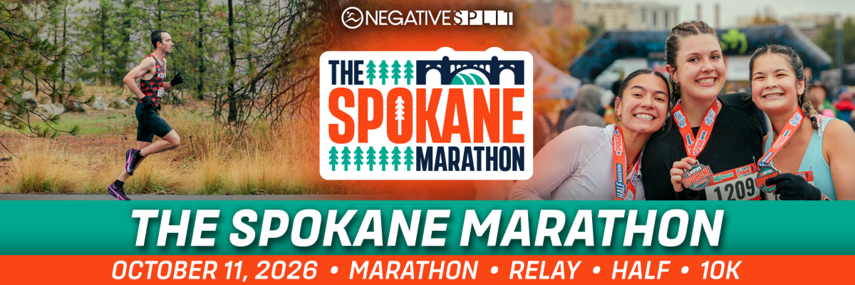
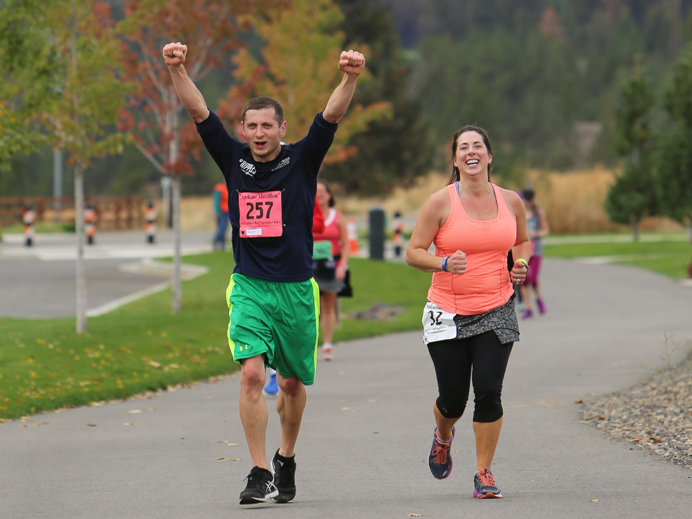
Experience the natural beauty of the Inland Northwest, with a course that winds along the Spokane River, through pine forests, and on the scenic Centennial Trail. Boston Marathon certified course.
Events
Marathon Team Relay
Half Marathon
Kids Fun Run
Increases to $20 after the first 100 people register. Registration ends October 11, 2026 at 8:30am PDT
The Spokane Marathon Virtual Run
CDA Marathon
Coeur d'Alene, ID 83814 US
05/24/2026
Pick 1 event from this race:
- Marathon — May 24, 2026 at 6:30am PDT
- Marathon - Early Start — May 24, 2026 at 5:30am PDT
- Half Marathon — May 24, 2026 at 7:00am PDT
- 10K — May 24, 2026 at 8:00am PDT
- 5K — May 24, 2026 at 9:00am PDT
- CDA Marathon Virtual Run — May 24, 2026 at 8:00am PDT
The Split
Spokane, WA 99201 US
04/12/2026
Pick 1 event from this race:
- Half Marathon — Apr 12, 2026 at 8:30am PDT
- Half Marathon - Early Start — Apr 12, 2026 at 7:30am PDT
- 10K — Apr 12, 2026 at 9:00am PDT
- 5K — Apr 12, 2026 at 9:15am PDT
- The Split Virtual Run — Apr 12, 2026 at 8:00am PDT
Windermere Marathon
Spokane, WA 99201 US
05/17/2026
Pick 1 event from this race:
- Marathon — May 17, 2026 at 7:00am PDT
- Marathon - Early Start — May 17, 2026 at 5:30am PDT
- Half Marathon — May 17, 2026 at 8:00am PDT
- 10K — May 17, 2026 at 8:00am PDT
- 5K — May 17, 2026 at 8:00am PDT
- Windermere Marathon Virtual Run — May 17, 2026 at 8:00am PDT
Mt. Spokane Trail Run
Mead, WA 99021 US
09/13/2026
Pick 1 event from this race:
- 25K — Sep 13, 2026 at 8:00am PDT
- 10K — Sep 13, 2026 at 8:30am PDT
- 5K — Sep 13, 2026 at 9:00am PDT
- Mt. Spokane Virtual Run — Sep 13, 2026 at 8:00am PDT
Hiawatha Spring Trail Run
Taft, MT 59867 US
06/07/2026
Pick 1 event from this race:
- 50K — Jun 7, 2026 at 6:00am PDT
- 25K — Jun 7, 2026 at 6:30am PDT
- 15K — Jun 7, 2026 at 7:15am PDT
- 10K — Jun 7, 2026 at 8:00am PDT
- Hiawatha Spring Virtual Run — Jun 7, 2026 at 8:00am PDT
Shamrock Shuffle
Spokane, WA 99201 US
03/15/2026
Pick 1 event from this race:
- Half Marathon — Mar 15, 2026 at 8:30am PDT
- 10K — Mar 15, 2026 at 9:15am PDT
- 5K — Mar 15, 2026 at 9:20am PDT
- Shamrock Shuffle Virtual Run — Mar 15, 2026 at 8:00am PDT
Hayden Lake Marathon
Hayden Lake, ID 83835 US
10/10/2026
Pick 1 event from this race:
- Marathon — Oct 10, 2026 at 7:30am PDT
- Half Marathon — Oct 10, 2026 at 8:00am PDT
- Quarter Marathon — Oct 10, 2026 at 8:30am PDT
- 5K — Oct 10, 2026 at 8:45am PDT
- Hayden Lake Virtual Run — Oct 10, 2026 at 8:00am PDT
Hiawatha Fall Trail Run
Taft, MT 59867 US
09/26/2026
Pick 1 event from this race:
- Marathon — Sep 26, 2026 at 9:00am PDT
- Marathon - Early Start — Sep 26, 2026 at 7:00am PDT
- Half Marathon — Sep 26, 2026 at 9:30am PDT
- 10K — Sep 26, 2026 at 10:00am PDT
- Hiawatha Fall Virtual Run — Sep 26, 2026 at 7:00am PDT
Run The Night Glow 5K
Spokane, WA 99212 US
08/22/2026
Pick 1 event from this race:
- 5K - Adults — Aug 22, 2026 at 8:10pm PDT
- Run The Night Virtual Run — Aug 22, 2026 at 8:10pm PDT
Cinco de Mayo
Portland, OR 97202 US
05/03/2026
Pick 1 event from this race:
- Half Marathon — May 3, 2026 at 9:00am PDT
- 10K — May 3, 2026 at 9:30am PDT
- 5K — May 3, 2026 at 9:45am PDT
- Cinco de Mayo Virtual Run — May 3, 2026 at 8:00am PDT
Grateful Dad
Portland, OR 97202 US
06/20/2026
Pick 1 event from this race:
- Half Marathon — Jun 20, 2026 at 9:00am PDT
- 10K — Jun 20, 2026 at 9:30am PDT
- 5K — Jun 20, 2026 at 9:45am PDT
- Grateful Dad Virtual Run — Jun 20, 2026 at 8:00am PDT
The Spokane Marathon
Spokane, WA 99201 US
10/11/2026
Pick 1 event from this race:
- Marathon — Oct 11, 2026 at 7:00am PDT
- Marathon Team Relay — Oct 11, 2026 at 7:00am PDT
- Half Marathon — Oct 11, 2026 at 8:00am PDT
- 10K — Oct 11, 2026 at 9:00am PDT
- The Spokane Marathon Virtual Run — Oct 11, 2026 at 8:00am PDT
Spring Dash
Coeur d'Alene, ID 83814 US
04/25/2026
Pick 1 event from this race:
- 5K — Apr 25, 2026 at 9:00am PDT
- 10K — Apr 25, 2026 at 8:45am PDT
- Half Marathon — Apr 25, 2026 at 8:00am PDT
Timberline Marathon
Clackamas Lake Historic Ranger Station, OR 97037 US
06/06/2026
- 06/07/2026
Pick 1 event from this race:
- Marathon - Saturday — Jun 6, 2026 at 8:30am PDT
- Half Marathon - Saturday — Jun 6, 2026 at 9:30am PDT
- Half Marathon - Sunday — Jun 7, 2026 at 9:30am PDT
CDA Marathon
Coeur d'Alene, ID 83814 US
05/24/2026
Pick 1 event from this race:
- Marathon — May 24, 2026 at 6:30am PDT
- Marathon - Early Start — May 24, 2026 at 5:30am PDT
- Half Marathon — May 24, 2026 at 7:00am PDT
- 10K — May 24, 2026 at 8:00am PDT
- 5K — May 24, 2026 at 9:00am PDT
- CDA Marathon Virtual Run — May 24, 2026 at 8:00am PDT
The Split
Spokane, WA 99201 US
04/12/2026
Pick 1 event from this race:
- Half Marathon — Apr 12, 2026 at 8:30am PDT
- Half Marathon - Early Start — Apr 12, 2026 at 7:30am PDT
- 10K — Apr 12, 2026 at 9:00am PDT
- 5K — Apr 12, 2026 at 9:15am PDT
- The Split Virtual Run — Apr 12, 2026 at 8:00am PDT
Windermere Marathon
Spokane, WA 99201 US
05/17/2026
Pick 1 event from this race:
- Marathon — May 17, 2026 at 7:00am PDT
- Marathon - Early Start — May 17, 2026 at 5:30am PDT
- Half Marathon — May 17, 2026 at 8:00am PDT
- 10K — May 17, 2026 at 8:00am PDT
- 5K — May 17, 2026 at 8:00am PDT
- Windermere Marathon Virtual Run — May 17, 2026 at 8:00am PDT
Mt. Spokane Trail Run
Mead, WA 99021 US
09/13/2026
Pick 1 event from this race:
- 25K — Sep 13, 2026 at 8:00am PDT
- 10K — Sep 13, 2026 at 8:30am PDT
- 5K — Sep 13, 2026 at 9:00am PDT
- Mt. Spokane Virtual Run — Sep 13, 2026 at 8:00am PDT
Hiawatha Spring Trail Run
Taft, MT 59867 US
06/07/2026
Pick 1 event from this race:
- 50K — Jun 7, 2026 at 6:00am PDT
- 25K — Jun 7, 2026 at 6:30am PDT
- 15K — Jun 7, 2026 at 7:15am PDT
- 10K — Jun 7, 2026 at 8:00am PDT
- Hiawatha Spring Virtual Run — Jun 7, 2026 at 8:00am PDT
Shamrock Shuffle
Spokane, WA 99201 US
03/15/2026
Pick 1 event from this race:
- Half Marathon — Mar 15, 2026 at 8:30am PDT
- 10K — Mar 15, 2026 at 9:15am PDT
- 5K — Mar 15, 2026 at 9:20am PDT
- Shamrock Shuffle Virtual Run — Mar 15, 2026 at 8:00am PDT
Hayden Lake Marathon
Hayden Lake, ID 83835 US
10/10/2026
Pick 1 event from this race:
- Marathon — Oct 10, 2026 at 7:30am PDT
- Half Marathon — Oct 10, 2026 at 8:00am PDT
- Quarter Marathon — Oct 10, 2026 at 8:30am PDT
- 5K — Oct 10, 2026 at 8:45am PDT
- Hayden Lake Virtual Run — Oct 10, 2026 at 8:00am PDT
Hiawatha Fall Trail Run
Taft, MT 59867 US
09/26/2026
Pick 1 event from this race:
- Marathon — Sep 26, 2026 at 9:00am PDT
- Marathon - Early Start — Sep 26, 2026 at 7:00am PDT
- Half Marathon — Sep 26, 2026 at 9:30am PDT
- 10K — Sep 26, 2026 at 10:00am PDT
- Hiawatha Fall Virtual Run — Sep 26, 2026 at 7:00am PDT
Run The Night Glow 5K
Spokane, WA 99212 US
08/22/2026
Pick 1 event from this race:
- 5K - Adults — Aug 22, 2026 at 8:10pm PDT
- Run The Night Virtual Run — Aug 22, 2026 at 8:10pm PDT
Cinco de Mayo
Portland, OR 97202 US
05/03/2026
Pick 1 event from this race:
- Half Marathon — May 3, 2026 at 9:00am PDT
- 10K — May 3, 2026 at 9:30am PDT
- 5K — May 3, 2026 at 9:45am PDT
- Cinco de Mayo Virtual Run — May 3, 2026 at 8:00am PDT
Grateful Dad
Portland, OR 97202 US
06/20/2026
Pick 1 event from this race:
- Half Marathon — Jun 20, 2026 at 9:00am PDT
- 10K — Jun 20, 2026 at 9:30am PDT
- 5K — Jun 20, 2026 at 9:45am PDT
- Grateful Dad Virtual Run — Jun 20, 2026 at 8:00am PDT
The Spokane Marathon
Spokane, WA 99201 US
10/11/2026
Pick 1 event from this race:
- Marathon — Oct 11, 2026 at 7:00am PDT
- Marathon Team Relay — Oct 11, 2026 at 7:00am PDT
- Half Marathon — Oct 11, 2026 at 8:00am PDT
- 10K — Oct 11, 2026 at 9:00am PDT
- The Spokane Marathon Virtual Run — Oct 11, 2026 at 8:00am PDT
Timberline Marathon
Clackamas Lake Historic Ranger Station, OR 97037 US
06/06/2026
- 06/07/2026
Pick 1 event from this race:
- Marathon - Saturday — Jun 6, 2026 at 8:30am PDT
- Half Marathon - Saturday — Jun 6, 2026 at 9:30am PDT
- Half Marathon - Sunday — Jun 7, 2026 at 9:30am PDT
Spring Dash
Coeur d'Alene, ID 83814 US
04/25/2026
Pick 1 event from this race:
- 5K — Apr 25, 2026 at 9:00am PDT
- 10K — Apr 25, 2026 at 8:45am PDT
- Half Marathon — Apr 25, 2026 at 8:00am PDT
CDA Marathon
Coeur d'Alene, ID 83814 US
05/24/2026
Pick 1 event from this race:
- Marathon — May 24, 2026 at 6:30am PDT
- Marathon - Early Start — May 24, 2026 at 5:30am PDT
- Half Marathon — May 24, 2026 at 7:00am PDT
- 10K — May 24, 2026 at 8:00am PDT
- 5K — May 24, 2026 at 9:00am PDT
- CDA Marathon Virtual Run — May 24, 2026 at 8:00am PDT
The Split
Spokane, WA 99201 US
04/12/2026
Pick 1 event from this race:
- Half Marathon — Apr 12, 2026 at 8:30am PDT
- Half Marathon - Early Start — Apr 12, 2026 at 7:30am PDT
- 10K — Apr 12, 2026 at 9:00am PDT
- 5K — Apr 12, 2026 at 9:15am PDT
- The Split Virtual Run — Apr 12, 2026 at 8:00am PDT
Windermere Marathon
Spokane, WA 99201 US
05/17/2026
Pick 1 event from this race:
- Marathon — May 17, 2026 at 7:00am PDT
- Marathon - Early Start — May 17, 2026 at 5:30am PDT
- Half Marathon — May 17, 2026 at 8:00am PDT
- 10K — May 17, 2026 at 8:00am PDT
- 5K — May 17, 2026 at 8:00am PDT
- Windermere Marathon Virtual Run — May 17, 2026 at 8:00am PDT
Mt. Spokane Trail Run
Mead, WA 99021 US
09/13/2026
Pick 1 event from this race:
- 25K — Sep 13, 2026 at 8:00am PDT
- 10K — Sep 13, 2026 at 8:30am PDT
- 5K — Sep 13, 2026 at 9:00am PDT
- Mt. Spokane Virtual Run — Sep 13, 2026 at 8:00am PDT
Hiawatha Spring Trail Run
Taft, MT 59867 US
06/07/2026
Pick 1 event from this race:
- 50K — Jun 7, 2026 at 6:00am PDT
- 25K — Jun 7, 2026 at 6:30am PDT
- 15K — Jun 7, 2026 at 7:15am PDT
- 10K — Jun 7, 2026 at 8:00am PDT
- Hiawatha Spring Virtual Run — Jun 7, 2026 at 8:00am PDT
Shamrock Shuffle
Spokane, WA 99201 US
03/15/2026
Pick 1 event from this race:
- Half Marathon — Mar 15, 2026 at 8:30am PDT
- 10K — Mar 15, 2026 at 9:15am PDT
- 5K — Mar 15, 2026 at 9:20am PDT
- Shamrock Shuffle Virtual Run — Mar 15, 2026 at 8:00am PDT
Hayden Lake Marathon
Hayden Lake, ID 83835 US
10/10/2026
Pick 1 event from this race:
- Marathon — Oct 10, 2026 at 7:30am PDT
- Half Marathon — Oct 10, 2026 at 8:00am PDT
- Quarter Marathon — Oct 10, 2026 at 8:30am PDT
- 5K — Oct 10, 2026 at 8:45am PDT
- Hayden Lake Virtual Run — Oct 10, 2026 at 8:00am PDT
Hiawatha Fall Trail Run
Taft, MT 59867 US
09/26/2026
Pick 1 event from this race:
- Marathon - Early Start — Sep 26, 2026 at 7:00am PDT
- Half Marathon — Sep 26, 2026 at 9:30am PDT
- 10K — Sep 26, 2026 at 10:00am PDT
- Hiawatha Fall Virtual Run — Sep 26, 2026 at 7:00am PDT
Run The Night Glow 5K
Spokane, WA 99212 US
08/22/2026
Pick 1 event from this race:
- 5K - Adults — Aug 22, 2026 at 8:10pm PDT
- Run The Night Virtual Run — Aug 22, 2026 at 8:10pm PDT
Cinco de Mayo
Portland, OR 97202 US
05/03/2026
Pick 1 event from this race:
- Half Marathon — May 3, 2026 at 9:00am PDT
- 10K — May 3, 2026 at 9:30am PDT
- 5K — May 3, 2026 at 9:45am PDT
- Cinco de Mayo Virtual Run — May 3, 2026 at 8:00am PDT
Grateful Dad
Portland, OR 97202 US
06/20/2026
Pick 1 event from this race:
- Half Marathon — Jun 20, 2026 at 9:00am PDT
- 10K — Jun 20, 2026 at 9:30am PDT
- 5K — Jun 20, 2026 at 9:45am PDT
- Grateful Dad Virtual Run — Jun 20, 2026 at 8:00am PDT
The Spokane Marathon
Spokane, WA 99201 US
10/11/2026
Pick 1 event from this race:
- Marathon — Oct 11, 2026 at 7:00am PDT
- Marathon Team Relay — Oct 11, 2026 at 7:00am PDT
- Half Marathon — Oct 11, 2026 at 8:00am PDT
- 10K — Oct 11, 2026 at 9:00am PDT
- The Spokane Marathon Virtual Run — Oct 11, 2026 at 8:00am PDT
Spring Dash
Coeur d'Alene, ID 83814 US
04/25/2026
Pick 1 event from this race:
- 5K — Apr 25, 2026 at 9:00am PDT
- 10K — Apr 25, 2026 at 8:45am PDT
- Half Marathon — Apr 25, 2026 at 8:00am PDT
Timberline Marathon
Clackamas Lake Historic Ranger Station, OR 97037 US
06/06/2026
- 06/07/2026
Pick 1 event from this race:
- Marathon - Saturday — Jun 6, 2026 at 8:30am PDT
- Half Marathon - Saturday — Jun 6, 2026 at 9:30am PDT
- Half Marathon - Sunday — Jun 7, 2026 at 9:30am PDT
Packet Pickup:
Saturday - 10/10/26 - GMC of Riverfront Park
Sunday - Race Day - North Bank Park
Start Times:
7:00am - Marathon
7:00am - Marathon Team Relay
8:00am - Half Marathon
8:30am - Kids Fun Run
9:00am - 10K
For more race information check out the Athlete Guide!
Official Race Charity Partner
Bloomsday Road Runners Club Youth Fund
The Bloomsday Road Runners Club (BRRC) Youth Fund is a fund within the BRRC that provides running-related support to youth in the Spokane area. Funds are used to host running events for kids, help student athletes purchase running shoes and other essential gear, and generally support young people in participating in athletics and track events.

The Start Line Is Waiting For You
Event Location


Sponsors