Template
My template
Pellentesque nibh felis, eleifend id, commodo in, interdum vitae, leo. Praesent eu elit. Ut eu ligula. Class aptent taciti sociosqu ad litora torquent per conubia nostra, per inceptos hymenaeos commodo in interdum vitae leo.
Mile Eight
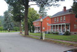
Ft Wright
Just before Mile 8 of the marathon, you will pass through the meticulously maintained Mukogawa Fort Wright Institute. Most of the buildings were built between 1897-1906. It was used for military purposes until 1957 and now serves as an intensive English and American culture program for the Mukogawa Women’s University. For more info Visit
Mile Five
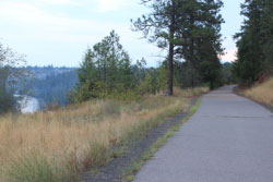
Centennial Trail
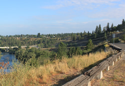
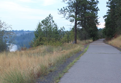
Just past mile 5 in the marathon (just past mile 7 in the half), you will run on a gradual downhill on the Centennial Trail high above the beautiful Spokane River. For more info on the Centennial Trail Click.
Mile 10
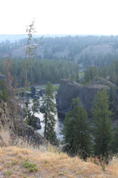
Spokane River
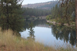
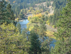
Just past a steep hill at Mile 10 you are rewarded with a scenic vista of basalt rock formations and the Spokane River. This view is just upstream of the Bowl and Pitcher ( If you aren’t one to notice the scenery, you can look forward to a nice gradual down river run for the next three miles--after a short steep downhill just past this spot). For info on hiking in the Bowl and Pitcher area after you finish the Spokane marathon, click Park.
Mile 13
Riverside State Park
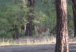
About the 13 mile mark-- If you are observant, you might be rewarded with a wildlife sighting such as this deer. The deer in Riverside State Park aren’t too quick to run away because they are used to seeing people. For more info on Riverside State Park go to Go!
Mile 15
Seven Mile Bridge
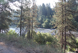
This is the view waiting for you just after you cross the 7- Mile Bridge. This is where you begin your trek back toward downtown Spokane and the finish line. This view is one of the most peaceful and serene on the course. Perhaps it will keep you from beginning to push too early. There is still a long way to go. And Doomsday Hill waits at mile 22.
Mile 21
The Calm before the Hill.
As you approach Doomsday Hill and are feeling the effects of having run a challenging 21 miles so far, you can still enjoy the grandeur of the river. It is your constant companion through this race.
Mile 22
Doomsday Hill
(Mile 22.5 of marathon and mile 9.3 of the half marathon) -- WHAT AN ACCOMPLISHMENT! You have just conquered the infamous Doomsday Hill which is tough in the 12 K Bloomsday race, and a HUGE accomplishment in a marathon! If you look back over your right shoulder, this is the view at the top of the hill… Or perhaps you can drive back out and look at the view after you are done with the race. For more info on this hill visit Doomsday Hill. Or to find out about the Bloomsday race go to Bloomsday Run
Mile 24
Gorgeous View
This is a gorgeous view from the newest portion (just finished in 2014) of the Centennial Trail. This is another spot that you may want to stop and enjoy, but don’t. The finish line is getting close! You can drive back to enjoy this one after the race too.
Mile 25
Monroe Street Bridge
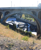
Just past the 25 mile mark (12 of the half), the runners pass under the Monroe Street Bridge. This is a front row view of the Spokane Falls and the gondolas that pass over them. For info on the Gondola ride that you may want to take after the race (you can sit!) visit Skyride
Finish
River Park
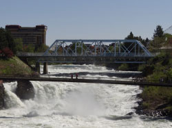
AND FINALLY.. the FINISH! It is fitting that runners finish right next to the falls of the Spokane River, the river that has been your constant companion through this epic run. The falls are quiet at this time of year, but here is a picture of what it looks like during runoff.
Mile 5
Gorgeous View
Pellentesque nibh felis, eleifend id, commodo in, interdum vitae, leo. Praesent eu elit. Ut eu ligula. Class aptent taciti sociosqu ad litora torquent per conubia nostra, per inceptos hymenaeos commodo in interdum vitae leo.

